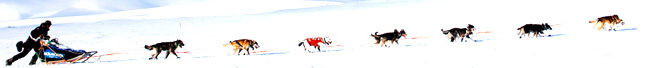

Sanka W. Dog
The fire siren sounds in Nome to announce that a dog team is approaching Front Street. It wails for the champion, the Red Lantern and every musher in between. Family, handlers and fans put on their coats, boots, hats and mittens and gather at the burled arch to welcome another Iditarod finisher Approaching the burled …
Out in the middle of no-where on the Nome to Council Highway sits the Safety Roadhouse. Looking back toward White Mountain, you see nothing but a few hills and snow, looking toward Nome you see nothing but flat land and snow. Looking out over the Bering Sea, you see nothing except sea ice and ice …
When mushers leave Elim, they head along the shore to a spot called Walla Walla. Here the trail crosses a peninsula and climbs over the Kwiktalik Mountains. The highest point that the mushers reach is 1,000 feet above sea level at Little McKinley Trail expert, Don Bowers, says this the toughest climb on the last …
Elim, an Inupaig village of 310 people is situated on the south shore of the Seward Peninsula or north shore of Norton Bay. Elim (EE-lum) is 100 miles east of Nome as the crow flies. Like all bush villages, Elim isn’t connected by road to the rest of Alaska. The only way to travel into …
Just out of Shaktoolik, teams will run through rolling tundra. Some of the villagers have reindeer herds that graze there. Once out on the sea ice, the great white expanse of Norton Bay can be overwhelming and confusing, especially in high winds. Don Bowers, Jr. calls the 50 mile section of trail from Shaktoolik to …
The village of Shaktoolik (shak-TOO-lick) is located on a little spit of land that juts out into the Norton Sound. There is one road that runs through town out to the air strip with houses, two stores, two churches, the school, the power plant, the city well, the clinic and the Armory spread along its …
The trail from Kaltag to Unalakleet (YOU-na-la-Kleet) follows a portage trail used by the Athabascans of the interior to travel to the Bering Coast to trade with the Inupiaq Eskimos. Russians also used the trail in their exploration and trading activities. Just 15 miles out of Kaltag, the mushers climb to 800 feet above sea level …
The village of Kaltag is perched high on the west bank of the Yukon River. Teams will make a short steep climb up the river bank and run down main street to the octagonal log community center in the middle of town. After sledding for many miles on the Yukon, mushers are happy to depart …
When teams reach Eagle Island, they have covered about half of the miles they will be traveling on the Yukon River. In his Trail Notes, Don Bowers, Jr. calls this section of trail that runs upstream and into the wind on the Yukon long and boring. He says, “There is nothing but wide-open river and …
Upon reaching Grayling, mushers and dogs have just covered 18 miles of the 148 mile leg of the Iditarod trail that runs up the frozen Yukon River. The village to village snowmachine trail is easy to follow but that doesn’t mean it’s an easy run. The Yukon River is famous for its blustery conditions. The …